You are here

Scientific Visualization

Primary tabs

The mission of this working group is to display and discuss the most important efforts to engage scientific visualization on issues of health and resilience.

General Topic Tags: 
Problem, Solution, SitRep, or ?: 
Group description: 
This Working Group is focused on scientific visualization pertinent to resilience and sustainability.
Group roles and permissions: 
Use default roles and permissions
Group visibility: 
Public - accessible to all site users

Members

admin Albert Gomez bart.stidham ChrisAllen DeannaPolk efrost
rwelborn

Email address for group

Ecological Footprint of Consumption Compared to Biocapacity

This map compares each country's total consumption Footprint with the biocapacity available within its own borders.

Many countries rely, in net terms, on the biocapacity of other nations to meet domestic demands for goods and services. For example: Japan imports Ecuadorian wood to make paper; Europe imports meat fed on Brazilian soy; the United States imports Peruvian cotton; and China obtains lumber from Tanzania.

  • World Total Biocapacity: 1.78 gha per capita
  • World Ecological Footprint of Consumption: 2.7 gha per capita (i.e. we are using more resources than the Earth can provide.)

Currently less than 20 percent of the world's population living in countries that can keep up with their own demands.

What is a global hectare (gha)?

A global hectare is a common unit that encompasses the average productivity of all the biologically productive land and sea area in the world in a given year. Biologically productive areas include cropland, forest and fishing grounds, and do not include deserts, glaciers and the open ocean.

Data source: Global Footprint Network's 2010 Edition.

Country / Region Tags: 
General Topic Tags: 
Problem, Solution, SitRep, or ?: 

YALE/TULANE ESF-8 PLANNING AND RESPONSE PROGRAM SPECIAL REPORT TYPHOON HAIYAN (YOLANDA PH) – THE PHILIPPINES

http://www.slideshare.net/YALE-ESF8--VMOC

In light of Typhoon Haiyan, the Yale-Tulane ESF #8 Planning and Response Program has produced special reports for current efforts. To access these reports, click here.

The Yale-Tulane ESF #8 Program is a multi-disciplinary, multi-center, graduate-level program designed to produce ESF #8 planners and responders with standardized skill sets that are consistent with evolving public policy, technologies, and best practices. The group that produced this summary and analysis of the current situation are graduate students from Yale and Tulane Universities. It was compiled entirely from open source materials.

(READ COMPLETE ARTICLE)

Country / Region Tags: 
Problem, Solution, SitRep, or ?: 

Philippines - Needs Assessments

                                               (CLICK ON MAP IMAGE BELOW TO ENLARGE)


ECHO Daily Maps - http://ercportal.jrc.ec.europa.eu/Maps/Daily-maps-catalogue#

Country / Region Tags: 
Problem, Solution, SitRep, or ?: 

STAR-TIDES - Typhoon Haiyan Update (As of 15 November 2013)

star-tides.net

The strength of STAR-TIDES is in its knowledge-sharing rather than as an operations center or a logistics hub.   We would like to do what is most useful in providing reach-back support.  Below are the latest updates from 4 broad areas (Equipment, Communications, Coordination, and Documentation):

(READ COMPLETE ARTICLE)

Country / Region Tags: 
Problem, Solution, SitRep, or ?: 

40 Maps That Will Help You Make Sense of the World


1. Where Google Street View is Available - Map by Google

submitted by Albert Gomez

twistedsifter.com - August 13, 2013

If you’re a visual learner like myself, then you know maps, charts and infographics can really help bring data and information to life. Maps can make a point resonate with readers and this collection aims to do just that.

Hopefully some of these maps will surprise you and you’ll learn something new.

(READ COMPLETE ARTICLE)

Country / Region Tags: 
General Topic Tags: 
Problem, Solution, SitRep, or ?: 

Global Warming and the Future of Storms

submitted by Albert Gomez


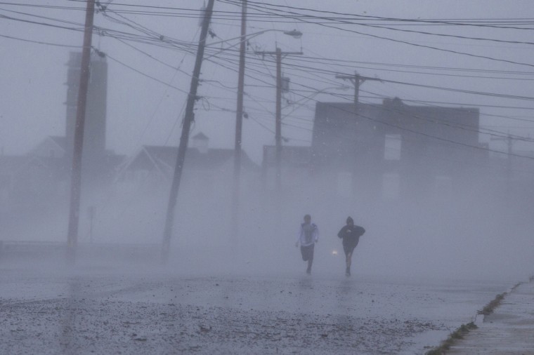
Hurricane Sandy battered towns along the United States east coast. Photograph: Scott Eisen/REUTERS

New research by Kerry Emanuel suggests that hurricanes will become more frequent and more intense

guardiannews.com - by John Abraham - July 26, 2013

Very recently, a publication appeared by perhaps the world's best-known hurricane scientist, Dr. Kerry Emanuel of MIT. Dr. Emanuel combined global computer simulations with more regional simulations to look into the future at the evolution of storms. What he found was surprising.

(READ COMPLETE ARTICLE)

STUDY - Downscaling CMIP5 climate models shows increased tropical cyclone activity over the 21st century
http://www.pnas.org/content/early/2013/07/05/1301293110.abstract

Country / Region Tags: 
Problem, Solution, SitRep, or ?: 

Geofeedia - Pioneering Location-Based Social Media Monitoring

geofeedia.com

Location-based streaming, search, monitoring, and analytics.

Create live, location-based social media streams, or “Geofeeds”. Once you create a Geofeed – by simply entering an address or drawing a boundary around a location on a map – you can search, monitor and analyze all social media activity from that location.

http://corp.geofeedia.com/company/how-it-works/

Country / Region Tags: 
Problem, Solution, SitRep, or ?: 

Global Earthquake Model (GEM)

globalquakemodel.org

GEM is a global collaborative effort with the aim to provide organisations and people with tools and resources for transparent assessment of earthquake risk anywhere in the world. By pooling data, knowledge and people, GEM acts as an international forum for collaboration and exchange, and leverages the knowledge of leading experts for the benefit of society.

http://www.globalquakemodel.org/

GEM Newsletter - June 2013

GEM Newsletter - July 2013

Country / Region Tags: 
Problem, Solution, SitRep, or ?: 

Open Data by Default – The New Mantra of G8 Leaders

G8 David Cameron thanked NGOs and other organisations for their lobbying on transparency

submitted by Albert Gomez

ecodesk.com - June 20, 2013

G8 leaders have committed to implementing transparent strategies to report pollution levels and energy consumption through the Open Data Charter, signed by all G8 countries this week.

Environmental protection is one of the key targets cited in the charter that can be achieved through the use of open data. This is arguably the most important climate change-related commitment, as under the environmental umbrella comes natural resource use, extractive industries and conflict minerals, positive governance and budget allocation.

(READ COMPLETE ARTICLE)

Country / Region Tags: 
Problem, Solution, SitRep, or ?: 

Video - TIME, GOOGLE AND NASA: Timelapse of the Earth Over the Last 30 Years

world.time.com - by Jeffrey Kluger

Spacecraft and telescopes are not built by people interested in what’s going on at home. Rockets fly in one direction: up. Telescopes point in one direction: out. Of all the cosmic bodies studied in the long history of astronomy and space travel, the one that got the least attention was the one that ought to matter most to us—Earth.

Country / Region Tags: 
Problem, Solution, SitRep, or ?: 

Pages

howdy folks
Page loaded in 0.790 seconds.