You are here

Disaster Response Network

Primary tabs

The mission of this working group is to following, understand, and improve the activities of disaster response networks around the world.

Group description: 
This Working Group is focused on the disaster response networks around the world.
Group roles and permissions: 
Use default roles and permissions
Group visibility: 
Public - accessible to all site users

Members

Albert Gomez bevcorwin eric.frost jranck mashalshah mdmcdonald
Michelle Frankl... Mika Shimizu SmithShawn SmShako

Email address for group

How Crises Model the Modern World

submitted by Robert G. Ross

atlantis-press.com - Journal of Risk Analysis and Crisis Response - May 2012

Abstract:

Crises are our new reality. “Black swans” are increasingly becoming the norm; our systems, environments, contexts are structurally prone to crises. Doing more of the same will not be the appropriate way to deal with modern crises: a paradigm shift is needed, based on a more accurate understanding of the dynamics of complex systems. This paper is an invitation to change the theoretical vision of crisis and crisis management, and the education and training of all actors involved.

Country / Region Tags: 
Problem, Solution, SitRep, or ?: 

Simulating the Effects of Different Actions to Minimize Disaster’s Consequences

submitted by Linton Wells

homelandsecuritynewswire.com - June 1, 2012

The European CRISMA project prepares for disasters by developing a decision-support tool to help the authorities, responders, communities, and private parties to prioritize the most important measures for saving lives and mitigating the effects of the crisis.

The CRISMA project, coordinated by VTT Technical Research Center of Finland, is developing a planning tool for crises which have immediate, extensive, and often irreversible consequences to the population and society. Crises of this type include natural disasters, toxic emissions, forest fires, and aircraft accidents.

(READ COMPLETE ARTICLE)

Country / Region Tags: 
Problem, Solution, SitRep, or ?: 

Improve Tsunami Warnings by Placing GPS on Commercial Ships

While in transit from Hawaii to Guam, the research vessel Kilo Moana detected the February 2010 Chilean tsunami. Credit: University of Hawaii, SOEST

submitted by Samuel Bendett

Homeland Security News Wire - May 8, 2012

Researchers find that commercial ships travel across most of the globe and could provide better warnings for potentially deadly tsunamis; this finding came as a surprise because tsunamis have such small amplitudes in the deep water, in contrast to their size when they reach the coastline, that it seemed unlikely that the tsunami would be detected using GPS unless the ship was very close to the source and the tsunami was very big

Commercial ships travel across most of the globe and could provide better warnings for potentially deadly tsunamis, according to a study published by scientists at the University of Hawaii – Manoa (UHM) and the National Oceanic and Atmospheric Administration’s Pacific Tsunami Warning Center.

Country / Region Tags: 
Problem, Solution, SitRep, or ?: 

Researchers Use GPS Data to Speed Up Tsunami Warnings


In this Jan. 2, 2005 file photo, a wide area of destruction is shown from an aerial view taken over Meulaboh, 250 kilometers (156 Miles) west of Banda Aceh, Indonesia. Researchers in the United States are hoping to use GPS data to speed up current warnings. (AP Photo/Dita Alangkara, File)

U.S. seismologists currently testing new warning system

by Andrew Pinsent - CBC News - May 5, 2012

Scientists in the United States have been testing an advanced tsunami warning system using GPS data, combined with traditional seismology networks, to attempt to detect the magnitude of an earthquake faster so warnings of potential tsunamis can get out to potentially affected areas sooner.

The prototype is called California Integrated Seismic Network (CISN), and is a collaboration between the United States Geological Survey (USGS) and The Gordon and Betty Moore Foundation, whose focus is on environmental conservation.

Country / Region Tags: 
Problem, Solution, SitRep, or ?: 

Building Resilience in African Nations is Paramount to Development

STUTTGART, Germany - Nancy Lindborg, assistant administrator for USAID's Bureau of Democracy, Conflict, and Humanitarian Assistance (DCHA), addresses staff of U.S. Africa Command, March 30, 2012, as part of the Command Speaker Series. Lindborg talked about USAID's efforts in Africa and discussed how U.S. AFRICOM can better work with the interagency organization to achieve common objectives. (U.S. AFRICOM photo by Danielle Skinner)

submitted by Samuel Bendett

U.S. AFRICOM Public Affairs - by Danielle Skinner

STUTTGART, Germany, Apr 3, 2012 — In developing countries experiencing chronic crises, such as those in the Horn of Africa, disaster risk reduction is often just as important, if not more so, than humanitarian response and recovery, according to a senior official from U.S. Agency for International Development (USAID).

Country / Region Tags: 
Problem, Solution, SitRep, or ?: 

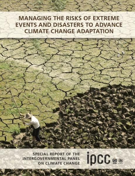
Special Report - Managing the Risks of Extreme Events and Disasters to Advance Climate Change Adaptation (SREX)

28 March 2012

The Intergovernmental Panel on Climate Change (IPCC) released its Special Report on Managing the Risks of Extreme Events and Disasters to Advance Climate Change Adaptation (SREX) on 28 March. The report assesses the evidence that climate change has led to changes in climate extremes and the extent to which policies to avoid, prepare for, respond to and recover from the risks of disaster can reduce the impact of such events. Please click here for an IPCC press release on the report, and here for the report itself.

http://www.ipcc.ch/news_and_events/news.shtml#.T3UOlfXh98F

Special Report - Overview

http://ipcc-wg2.gov/SREX/

Special Report - Press Release (4 page .PDF file)

Country / Region Tags: 
General Topic Tags: 
Problem, Solution, SitRep, or ?: 

Global Warming Presents Historic Disaster Risk, Report Says

submitted by Samuel Bendett


Mumbai is among the densely populated cities that scientists say is at great risk. (Photo: Getty Images)

by Seth Borenstein - Associated Press - yahoo.com - March 28, 2012

WASHINGTON — Global warming is leading to such severe storms, droughts, and heat waves that nations should prepare for an unprecedented onslaught of deadly and costly weather disasters, an international panel of climate scientists said in a new report issued Wednesday.

The greatest threat from extreme weather is to highly populated, poor regions of the world, the report warns, but no corner of the globe — from Mumbai to Miami — is immune. The document by a Nobel Prize-winning panel of climate scientists forecasts stronger tropical cyclones and more frequent heat waves, deluges, and droughts.

(READ COMPLETE ARTICLE)

Country / Region Tags: 
General Topic Tags: 
Problem, Solution, SitRep, or ?: 

Exercise 24: Using Social Media for Crisis Response

submitted by Samuel Bendett


worldfinancialreview.com - By George H. Bressler, Murray E. Jennex & Eric G. Frost

“Can populations self-organize a crisis response? This is a field report on the first two efforts in a continuing series of exercises termed Exercise 24 or X24. These exercises attempted to demonstrate that self-organizing groups can form and respond to a crisis using low-cost social media and other emerging web technologies.”

(READ COMPLETE ARTICLE)

Country / Region Tags: 
Problem, Solution, SitRep, or ?: 

Predicting Locations of Emergency & Damage During Disaster Using VGI Data

submitted by Alister Wm Macintyre

                                                     (CLICK ON IMAGE BELOW - TO ENLARGE)


ushahidi.com - by Prateek Budhwar

The VGI data obtained from the Ushahidi-Haiti platform during the first 72 hours of Earthquake in Haiti can be used for predicting the locations of ‘Emergency and damaged areas’ using Ushahidi Reports in Port-au-Prince. Two rapid and very successful VGI deployments helped coordinate disaster response after a devastating magnitude 7 earthquake struck Haiti in January 2010.

OpenStreetMap (OSM) project volunteers working outside Haiti created a digital street map of Port-au-Prince and other places in Haiti very rapidly using fine-resolution imagery to trace vector maps of streets and other features.

(READ COMPLETE ARTICLE)

Country / Region Tags: 
Problem, Solution, SitRep, or ?: 

Mexico Quake Tweet Volume and Characteristics

submitted by Samuel Bendett

Sender: crisismappers
Date: Tue, 20 Mar 2012 13:55:14 -0700
To: <crisismappers>
ReplyTo: crisismappers
Subject: [CrisisMappers] Mexico quake tweet volume and characteristics
Some relatively random data points...

We've saw about 10,000 English tweets in the first hour and 23,000 in the second. Third hour is down, will be about half the rate of the second hour if sustained.

Recurring themes include words like rattle, suffer, long slow roller, hard, saddened, worried, awful, hate, bad.

I'm seeing a fair bit of "help us report" tweets, which is coming from a tweet that said "earthquake preparedness helps us report none to minor damage and no victims so far," from Mexico City.

English-language tweets from Mexico are making up 8 percent of the total. 55 percent are from the U.S.

Spanish tweets - 488 in the first hour, 1,400 in the second and current rate will product about 1,000 in the third hour.

Most common words in the Spanish tweets are disfrutar and malo.

Spanish tweets are coming almost 50/50 from Mexico and the U.S.

Almost 75 percent of the Spanish tweets were from men, v. a close to 50/50 split for English.

Country / Region Tags: 
Problem, Solution, SitRep, or ?: 

Pages

howdy folks
Page loaded in 0.632 seconds.